

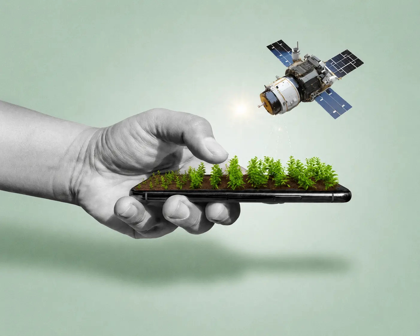
In today's era where everything is being automated, tracked, and generated by modern satellite networks and sophisticated electronic guidance systems, we are becoming too much dependent on technology. Somehow it is incredibly useful for us, accelerating field operations and optimizing yields, and somehow it is not, introducing hidden vulnerabilities that traditional farming communities could never have anticipated. We believe we have conquered the unpredictability of nature with our advanced machinery, yet we remain fundamentally exposed to cosmic forces operating millions of miles away.
Precision agriculture was designed to make our rural work faster and with better efficiency, minimizing overlaps, reducing fertilizer wastage, and ensuring neat, straight seed lines across expansive agricultural terrains. But when we just ended up depending on automated Real-Time Kinematic (RTK) networks, global navigation satellite systems (GNSS), and autonomous driving features for our everything, we don't know where we actually forgot the traditional, resilient methods of manual oversight and visual field alignment. We don't know how fragile our ultramodern systems truly are until the skies look clear, but our fields descend into total mechanical chaos.
So this article basically is going to get you all aware about what we should do with advanced satellite-guided machinery and what we should do with authentic and original manual interventions when solar anomalies compromise our agrarian tech. It explores how intense geomagnetic storms strike our rural core, the real-world operational breakdowns occurring across Indian farmlands, and the critical lack of advisory mechanisms that leaves our independent farmers completely defenseless in the face of stellar disruptions.
Autonomous Satellite Guidance and the Efficiency It Provides
With the introduction of modern satellite receivers, heavy mechanical cultivation has become significantly easier and more efficient to execute, precisely calculating the paths of our daily day-to-day agricultural operations. These tools have redefined field logistics not only in massive Western corporate setups but increasingly across the progressive farming belts of Punjab, Haryana, and Western Uttar Pradesh. Automated steering systems are evolving beyond basic positioning indicators into advanced smart setups that can regulate row spacing down to the exact centimeter, analyze topography, map crop yields, and manage automated chemical spraying with minimal manual input.
These tech solutions help you get real-time path corrections while managing your field coordinates and automated equipment arrays, making critical sowing decisions on your base for your seasonal crop cycles or agricultural businesses. These systems work upon complex satellite triangulations, capturing radio frequency signals transmitted across space, and help you choose from highly efficient, structured path patterns to maximize your field area. In regions undergoing massive mechanical advancement, high-grade tractors equipped with smart receivers have successfully compressed multi-day tilling schedules into a matter of mere hours, allowing progressive growers to scale operations aggressively.
To understand the current scale of this high-tech agrarian landscape, one can look at several notable hardware ecosystems, subscription networks, and guidance platforms that forward-thinking growers utilize to initiate their automated farming journeys online and in the fields:
Notable Agrarian Navigation & Correction Frameworks:
- John Deere StarFire Series — High-precision satellite receivers deployed on autonomous tractors to provide real-time field navigation.
- Trimble Agriculture — Advanced automated guidance systems and correction services designed to optimize row alignment and field mapping.
- Topcon Positioning — Precision steering and cloud-mapped GNSS infrastructure tailored for automated crop sowing and spraying.
- Hexagon NovAtel — High-performance correction tech tracking multiple satellite constellations to ensure absolute positioning accuracy.
- GEODNET Fixed Reference Stations — A global network of terrestrial reference stations tracking space weather to reduce atmospheric drift.
- ISRO NavIC Network — India's regional satellite navigation structure, increasingly integrated into indigenous agricultural equipment.
Cons of Using Satellite Systems for Precision Farming
Satellite guidance, as we know, is still an artificial, rigid framework dependent on clear atmospheric transmission lines, not an adaptive human mindset that can think flexibly like traditional farmers and make immediate manual corrections after observing unexpected behavioral changes in the field. Automated tracking is entirely reliant on the smooth transit of radio signals from space down to Earth. When these signals encounter severe external interference, the entire infrastructure breaks down, failing to account for localized dynamic variations and leaving the vehicle fundamentally disoriented.
In recent technological evaluations, it has been observed that major commercial satellite correction services do provide extreme accuracy under ideal conditions, but during periods of heightened atmospheric turbulence, a massive drop in positioning reliability occurs. Studies indicate a variance of over 65% accuracy drop when tracking signals through highly disturbed ionospheric layers. This translates to a critical error rate where every 2nd out of 5th attempts by the guidance system to establish an absolute sub-inch lock gets completely wrong, leaving a substantial error margin in field alignment. While a minor steering deviation might look negligible on paper, in dense row-crop farming, it causes severe structural overlap or misses, resulting in heavy crop damage and major financial loss for the farm business.
Advertisement
Giving constant coordinate inputs, rebooting receivers, and continuously checking each and every path record quickly becomes an endless loop of detecting shifted lines, getting records corrupted, and frantically trying to recalibrate. It turns what was supposed to be an effortless automated operation into a tiresome, stressful chore of the day, consuming far more time and strenuous mental energy than standard manual plowing ever did, ultimately giving farmers major headaches and migraines in the future.
"Our tractors acted like they were demon possessed... lurching back and forth across the fields as if the steering wheels had minds of their own, making it completely impossible to maintain a straight line during the peak sowing window."
The Invisible Solar Culprit: How the Sun Disrupts the Soil
The true source of this mechanical disorientation does not lie within a software glitch or a structural component failure; it originates ninety-three million miles away on the surface of the Sun. Space weather, driven by violent explosions known as solar flares and coronal mass ejections (CMEs), regularly throws vast clouds of highly charged plasma into outer space. When these energetic particles collide with the Earth's magnetic shield, they trigger massive geomagnetic storms that severely agitate the ionosphere — the upper layer of our atmosphere responsible for reflecting and transmitting navigation frequencies.
To grasp why this severely destabilizes a modern tractor, one must look at how precision navigation functions. A standard standalone GPS receiver provides general positioning, but high-end farming demands millimeter-level accuracy, achieved via Real-Time Kinematic (RTK) networks. These setups rely on a direct, unhindered comparison between a satellite signal and a fixed ground station. During a severe solar storm, the rapid fluctuation of Total Electron Content (TEC) creates intense ionospheric scintillation, distorting the radio signals with variable time delays. We can mathematically understand this relationship as the position error increasing exponentially with the rate of change of the atmospheric disturbance index, expressed as:
ΔP = α × ROTI
Where ΔP represents the total spatial positioning error, ROTI is the Rate of TEC Index measuring ionospheric turbulence, and α is a regional scaling constant.
As the Sun's activity reaches the peak of its 11-year solar cycle, these bursts become exceptionally frequent and intense, plunging satellite communication lines into a thick, invisible fog of charged particles. The receiver loses its absolute phase lock, experiencing a phenomenon known as "GPS drift," which silently misaligns row paths without throwing an explicit system error code.
The Indian Context: Blind Progress and Missing Warnings
While Western manufacturers and agricultural cooperatives are slowly beginning to monitor space weather alerts, the situation across India's agricultural heartlands remains deeply troubling and chaotic. Over the past decade, Indian agriculture has undergone an aggressive, silent push toward technological modernization. Eager to maximize efficiency, affluent farmers have heavily invested in high-tech guidance systems and customized RTK corrections. However, this massive influx of modern technology has been introduced without an equivalent system of safety education, leaving our rural sectors extremely vulnerable to cosmic disruptions.
When a severe solar storm strikes, Indian farmers have absolutely no idea why their expensive, automated tractors suddenly begin veering off course or steering erratically. There are no localized space-weather alert dashboards tailored for rural communities, no regional advisories translated into local vernaculars, and absolutely no training programs conducted by agricultural extension departments. The independent farmer is left completely in the dark, watching a multi-lakh steering setup malfunction during the most critical, time-sensitive planting days of the season, entirely unaware that the root cause sits in the sky rather than the machine.
"Spend consciously on high-tech advancements, but remember to save intentionally the fundamental human skills that keep you independent of the machine grid."
The ultimate magic of resilient farm management dictates that when you actively guide, observe, and calculate your field paths yourself, your human mind remains fully aware of what you are doing, immediately sensing whether a steering arc is correct or wrong. This manual discipline creates an intuitive baseline, forcing a grower to think twice before blindly trusting an unmonitored digital display — which is the core principle of long-term success, asset preservation, and true sustainability in modern agricultural businesses.
Read Further
- The Challenge of Ionospheric Scintillation in Precision Agriculture — GPS World, 2024
- How the Strong Solar Storm Could Impact GNSS — GPS World, 2024
- Solar Storm Disruptions? New Tech Keeps GPS on Track — Farm Progress, 2025
Disclaimer: All the investigative data, factual relationships, and scientific correlations provided above were synthesized from verified internet resources, astronomical studies, and recent agricultural field research. This technical synthesis should not be taken as an official quote from our website or definitive financial advice regarding specific equipment procurement.
Advertisement