

In today's era where geopolitical landscapes are rapidly shifting and environmental vulnerabilities are at an all-time high, our collective dependence on cross-border resource management has become a matter of literal survival. Water, the ultimate life-giving resource, is increasingly caught in the crosshairs of nationalist politics, regime changes, and diplomatic inertia. For three decades, the 1996 Ganges Water Sharing Treaty stood as a pioneering monument of bilateral cooperation between India and Bangladesh, proof that an upper riparian giant and a lower riparian delta could sit across a table and carve out a structured mechanism for survival. But as the clock ticks relentlessly toward December 2026, we find ourselves standing at the precipice of a silent catastrophe: negotiations have completely ground to a halt, leaving the fate of millions of lives hanging in the balance. We live in a world where modern states are quick to announce high-level strategic partnerships, yet when it comes to the raw, visceral reality of sharing lifelines like the Ganges River, the machinery of diplomacy easily rusts. The current treaty, signed on December 12, 1996, by the then Indian Prime Minister H. D. Deve Gowda and Bangladeshi Prime Minister Sheikh Hasina, was structured for a fixed thirty-year duration. It lacks any clause for automatic renewal or extension. Instead, it demands an active, intentional consensus between the two governments to either update its parameters or draft a successor framework. Today, with less than several months remaining on the ultimate deadline, the diplomatic channels are shockingly frozen, creating a vacuum that threatens to destabilize not just bilateral ties but the ecological and economic equilibrium of the entire Bengal Delta.
The 1996 Treaty and the Structured Efficiency It Provided
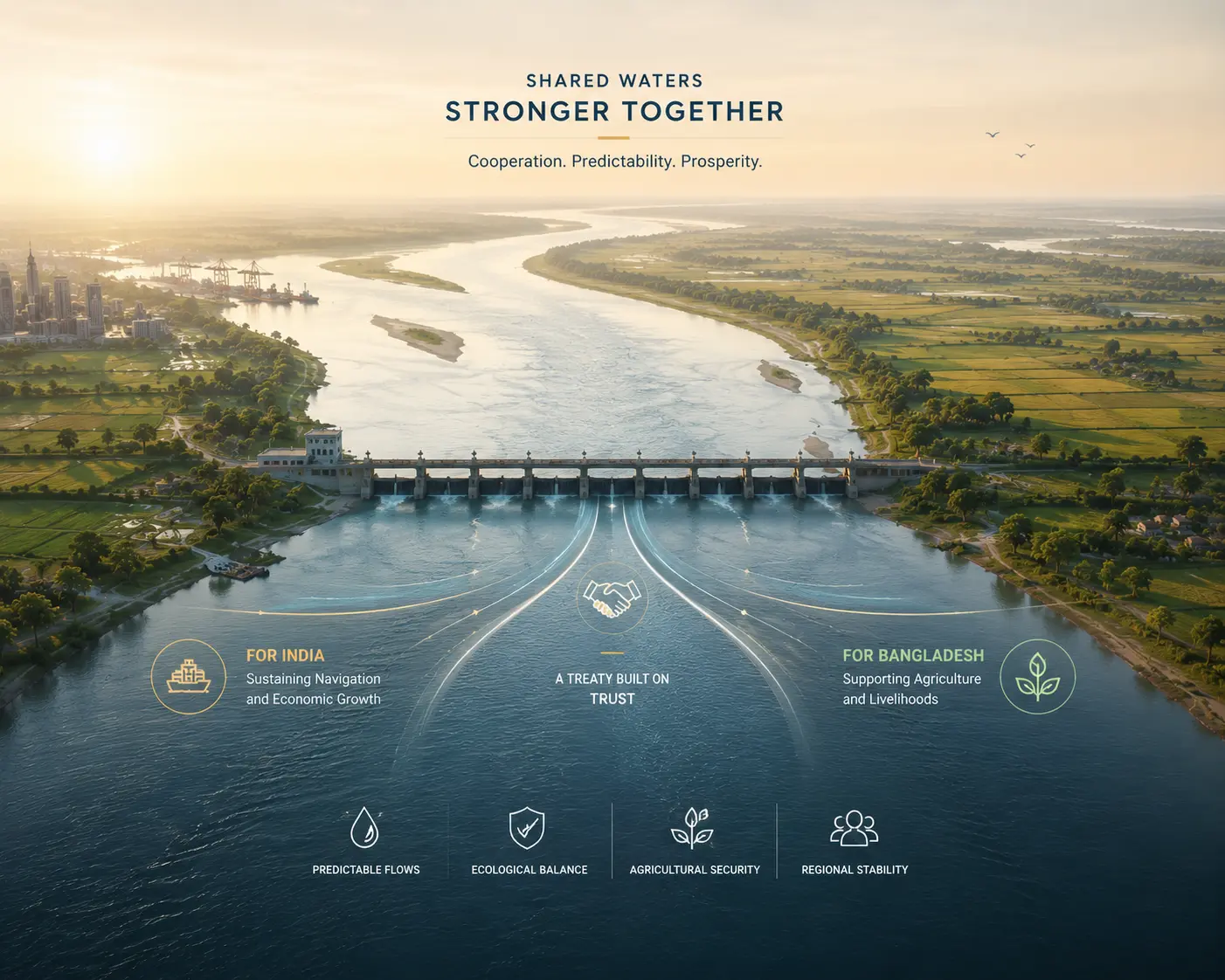
To understand why the current standstill is so dangerous, one must appreciate how the 1996 Ganges Water Sharing Treaty brought structural efficiency to a volatile hydro-political relationship. Before the treaty's inception, the construction of the Farakka Barrage by India in 1975 — situated mere 18 kilometers upstream from the international border — was a permanent bone of contention. The barrage was built to divert water into the Bhagirathi-Hooghly river system to flush out silt and maintain the navigability of the Kolkata Port. However, this upstream diversion left Bangladesh facing drastic dry-season water shortages, severely crippling its agriculture and altering its salinity dynamics. The 1996 agreement brought an element of predictability to this chaos. Operating primarily during the critical dry season from January 1 to May 31, the treaty implemented a rigid, mathematics-based formula for water allocation at the Farakka site, broken down into ten-day cycles:
- High-Flow Balance: If the total water availability at Farakka remains 75,000 cusecs or more, India and Bangladesh split the sharing formula equally, with each nation receiving 50% of the natural flow.
- Low-Flow Safeguard: If the available flow drops below 70,000 cusecs, Bangladesh is guaranteed a baseline of 35,000 cusecs, while India retains the remainder to preserve its crucial navigational interests at the Kolkata Port.
- Critical Window Alternation: During the absolute leanest phase between April 21 and May 31, the treaty introduces an alternating schedule where each country is guaranteed a minimum of 35,000 cusecs in alternate ten-day blocks, shielding both ecosystems from extreme dryness.
For nearly thirty years, this technical framework allowed both nations to manage their agricultural planning and municipal allocations with a sense of certainty. For India, it safeguarded the economic viability of West Bengal's maritime infrastructure. For Bangladesh, it provided a predictable inflow that preserved the hydrological sanity of the Padma River, irrigated vast swaths of fertile cropland, and pushed back the destructive intrusion of saltwater from the Bay of Bengal into the Sundarbans. It was a rule-based, structure-dependent victory for diplomacy.
"Cooperation thrives when structures are respected, but it collapses the moment political will is replaced by silence."
Cons of the Existing Treaty and the New Hydrological Realities
However, despite its historical success, the 1996 Treaty is fundamentally a product of its time — and that time has passed. The document suffers from inherent vulnerabilities that have become painfully visible under the weight of twenty-first-century environmental crises. The most damning flaw of the existing arrangement is its absolute dependence on historical flow data that no longer matches reality. The treaty was negotiated based on the average water volumes recorded at Farakka between 1948 and 1988, assuming a steady, predictable supply from the Himalayan glaciers and northern Indian plains. Recent hydrological studies reveal a massive shift in the river's behavior. Due to extensive upstream abstractions, heavy agricultural pumping in Uttar Pradesh and Bihar, and the unpredictable onset of climate change, the actual volume of water reaching Farakka has frequently fallen short of the treaty's baseline assumptions. When the river runs dry, the mathematical formula becomes a source of intense friction. The treaty contains no fallback mechanism or joint management plan for prolonged drought years, meaning that a 65% drop in expected flow triggers immediate deficits on both sides, transforming a cooperative template into a zero-sum game of fingerpointing.
Furthermore, the treaty is strictly a "point-source" agreement, focusing entirely on the water levels at Farakka rather than adopting a comprehensive, basin-wide governance philosophy. The Ganges basin spans four countries — China, Nepal, India, and Bangladesh — yet the 1996 framework pretends the river exists in a bilateral bubble. By ignoring upstream dam construction in Nepal and the broader impact of deforestation and industrial pollution across the river basin, the treaty has failed to protect the long-term ecological health of the river. It calculates volume, but it ignores sustainability.
The Current Deadlock: Political Turmoil and Stalled Negotiations
The technical flaws of the treaty could theoretically be resolved through rigorous diplomatic review, but the real tragedy of 2026 is that the political conditions required for negotiation have entirely evaporated. The relationship between New Delhi and Dhaka has plunged into a state of severe diplomatic paralysis following massive domestic changes within Bangladesh. The sudden ouster of the long-ruling Awami League administration led by Sheikh Hasina — who enjoyed an exceptionally warm and strategically aligned relationship with New Delhi — has completely altered the bilateral equation. The rise of the new administration in Dhaka, led by the Bangladesh Nationalist Party (BNP) under Tarique Rahman, has fundamentally shifted Bangladesh's diplomatic stance. The historical grievances regarding India's border management, structural trade imbalances, and the long-delayed Teesta River treaty have resurfaced with intense urgency. Dhaka now views India's diplomatic outreach as superficial, particularly given New Delhi's reluctance to address sensitive issues, such as the political status of the exiled former Prime Minister. In retaliation, the current Bangladeshi administration has initiated a calculated diplomatic pivot toward alternative regional powers, most notably China, seeking strategic leverage and massive infrastructure funding for water management projects like the Padma River Barrage. This political shift has met a cold, unyielding response in New Delhi. Indian policymakers view Bangladesh's growing alignment with Beijing as a direct threat to its regional security and strategic neighborhood policy.
Advertisement
Consequently, the motivation to offer concessions or fast-track water-sharing renewals has dropped significantly. The 86th meeting of the Joint Rivers Commission and parallel sessions of the Technical Committee on the Ganges held in Kolkata earlier this year failed to make any substantive progress. Instead of engaging in active, future-oriented treaty restructuring, the discussions disintegrated into repetitive procedural arguments, leaving the formal negotiation process completely deadlocked. The domestic political landscape inside India adds another layer of complication to this gridlock. Under India's federal structure, water is a state subject, meaning the central government in New Delhi cannot effectively execute an international river treaty without the political consent of the riparian states involved. The government of West Bengal, led by Chief Minister Mamata Banerjee, remains fiercely opposed to any water-sharing agreements that might decrease water levels within her state. With West Bengal facing its own dry-season water anxieties and agricultural distress, regional leaders have consistently blocked any attempt by New Delhi to guarantee higher water volumes to Bangladesh, rendering the central government domestically paralyzed.
"When local politics dictates international survival, diplomacy is the first casualty."
The Impending Catastrophe of an Agreement Vacuum
If the treaty expires in December 2026 without a successor framework or a formal extension, both nations will enter an unprecedented "agreement vacuum." In the absence of a legally binding bilateral mechanism, India would technically have the unilateral authority to control and divert the flows at Farakka according to its own domestic and industrial priorities. For Bangladesh, this is nothing short of an existential nightmare. The downstream consequences of unregulated water diversion would trigger a cascading humanitarian, economic, and ecological disaster across its northern and southwestern districts. Agriculture, the backbone of the Bangladeshi economy, would bear the immediate brunt of this crisis. Millions of farmers who depend on the Ganges-Padma river system for surface irrigation during the dry season would see their canals dry up, devastating the production of high-yield Boro rice crops. To compensate, communities would be forced to engage in uncontrolled groundwater extraction, rapidly depleting regional aquifers, triggering massive land subsidence risks, and accelerating the dangerous contamination of drinking water supplies with naturally occurring arsenic. The ecological toll would be equally devastating. A drastic reduction in freshwater inflow would allow seawater from the Bay of Bengal to penetrate deep into the tidal river networks of southwestern Bangladesh. This massive surge in salinity would permanently alter the fragile ecosystem of the Sundarbans — the world's largest mangrove forest and a UNESCO World Heritage site — killing off native flora and fauna, ruining local fisheries, and destroying the natural storm buffer that protects millions of delta residents from increasingly violent tropical cyclones.
The Path Forward: Moving from Conflict to Climate Resilience
Breaking this dangerous deadlock requires both New Delhi and Dhaka to urgently look beyond old political grievances and realize that water security is no longer a zero-sum diplomatic game. It is a shared challenge of regional climate survival. The traditional approach to river diplomacy — centered entirely on dividing rigid volumes of water at a single geographical coordinate — must be abandoned. Instead, both nations must work to formalize a comprehensive "Climate and Water Resilience Pact" that adapts to the volatile hydrological realities of the twenty-first century. A modernized framework must incorporate dynamic, climate-resilient data-sharing networks. Rather than relying on outdated mid-century flow averages, a new treaty should utilize real-time satellite telemetry and joint hydrological modeling to adjust water allocations fluidly based on actual seasonal availability. When climate-driven droughts reduce the river's volume, the resulting deficits must be shared equitably and transparently, eliminating the suspicion and blame that currently paralyzes bilateral relations.
Furthermore, both governments should collaborate to establish a permanent "Joint Himalayan-Delta Research Center." This institution would unite scientists, hydrologists, and environmental economists from both nations to study changing monsoon patterns, glacial melt rates, and deltaic sedimentation styles. By depoliticizing the scientific data, both countries can build a shared, objective understanding of the river's health, transforming the Ganges from a source of geopolitical friction into a channel for shared regional resilience.
"To save the river is to save ourselves; a future of shared water is the only alternative to mutual ruin."
The impending expiry of the 2026 Ganges Water Treaty is a critical test for South Asian statesmanship. It forces both India and Bangladesh to decide whether they will let short-term political shifts and regional rivalries dictate the long-term survival of their people, or whether they will rise to the occasion and build a sustainable hydro-political partnership. Time is running out, the river is drying up, and the cost of continued silence is a price that neither nation can afford to pay.
Read Further
- Ganges Treaty Expiry Looms as Bangladesh–India Water Tensions Rise — Dhaka Tribune, 2026
- The Ganga Is Under Stress — The Treaty Needs More Than Renewal — Down To Earth / Centre for Science and Environment, 2026
Disclaimer: All the data, historical references, and analytical positions provided in this article were compiled from contemporary internet resources, international water diplomacy journals, and recent bilateral studies on South Asian transboundary river management. This material is prepared for informational and educational purposes and should not be construed as official diplomatic advice or a formal institutional quote.
Advertisement